
“Though I have lived in London for longish periods at various times in my life, I have never been a Londoner, so that its associations to me are more literary and historic than personal. Every time I visit it, I am saddened by seeing changes for the worse: the growing inelegance; the loss of character; the disappearance of landmarks and their replacement by flat and faceless glass houses.” ~ Don’t Tell Alfred, by Nancy Mitford
Nancy Mitford wrote these words in the late 1950s. How much more would she feel had changed for the worse in the seven decades since? Yet much has also changed for the better. Wondrous modern structures like the Shard now loom on the horizon, and vacant bomb sites have been filled. Rationing had only recently ended. The Thames is a much a cleaner river, and so is the air. Between 1948 and 1962 the smog could get so bad that smoke concentrations were 56 times higher than the normal level and visibility was so bad that people could not see where they were walking.
As I crystallize into a grumpy old woman bemoaning the horrors of the modern world, I find my own thoughts echoing Nancy Mitford’s, when walking through Adelaide. Once a flat, open plain between sea and hills, inhabited only by the Kaurna and dotted with emus, wallabies and kangaroos, by the late nineteenth century there were 160,000 European settlers living in the new built town of Adelaide with its broad streets, green parks and Victorian buildings of stone and red brick, decorated with finials and furbelows, and none more than three stories high. Our first ‘skyscraper’ was the Vercoe Building on North Terrace, built six stories high in 1912. Today, our tallest building – Frome Central Tower One – has 37 floors.
Back in 1900, the city’s trams were pulled by horses. The electric trams that followed have come and gone and come again. The Town Hall and the Post Office building remain – although no longer a post office – but many of the older, shorter buildings have long been replaced by high rises of startling sobriety and unloveliness.
And yet, the wide belt of parkland that encircles our city and North Adelaide – for all that we keep encroaching upon it – is still a wondrous memorial to the foresight of our forefathers, as Kerryn Goldsworthy remarks in her little book ‘Adelaide.’ “Despite the best efforts of developers… the city has somehow managed to retain most of the original green belt…” wrapping the CBD and north Adelaide in its protective hug.
In 1837, William Light proposed that the ‘park grounds’ include 700 acres south of the River Torrens and 342 acres north of the river. He also included 46 acres of city squares in his plan: Hindmarsh, Hurtle, Light, Whitmore and Wellington and Victoria. Originally, the parklands consisted of more 2,300 acres.
Once filled with an abundance of wildlife, this changed rapidly as the population of the city grew. First settled in 1836, less than two decades later much of the parkland had been cleared of trees for building and firewood, scarred by clay and lime pits, over-grazed by cattle, goats and sheep, covered in rubbish dumps and emptied of native animals. As native vegetation was removed, settlers introduced many foreign species to create a more European style landscape. The river was soon polluted by tanneries, logging and chemical plants.
Sadly, in the early days, the indigenous Kaurna people were deemed a nuisance and pushed to the fringes of the new town, their nudity a horror to the English women, their corroborees described as “discordant orgies.” All too soon their numbers dwindled, and the Kaurna faded from the scene. According to one observer, “the introduction of civilised habits seems to be fatal to their continued existence, independently of the vices and disease we have brought among them, to our disgrace, which have hastened their destruction.”
Attempts were made to curtail the damage in 1850. Squatters and aboriginals were unceremoniously removed from the parklands, and the area fenced. Yet the misuse continued. In 1880, the City Council requested a plan for the beautification of the Park Lands. Although the report was presented later that year, it was not acted upon for almost two decades. Finally, in 1899, progress was made in planting and landscaping the parklands.
Despite attempts to contain the damage, in 1936, it was reported that more than 25% of the total area had been leased for other purposes. A survey in 2003 noted that originally the parklands were designated community land that could not be sold, yet much had been alienated for State and Federal Government purposes. By 2018, the Adelaide Parklands Preservation Society claimed that 570 acres have been misappropriated from the original parcel of land designated as parklands for the people of Adelaide.
On the south side of the Torrens, the linear park maintains a narrow strip of public walking paths between the river and the elegant nineteenth century public buildings along North Terrace. These buildings include the Railway Station, Parliament Houses (old and new), Government House, the museum, the South Australian State Library and Art Gallery, and two universities.
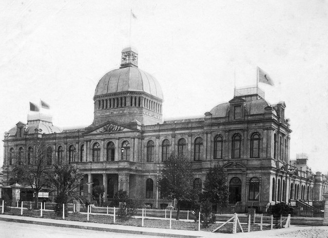
Unfortunately, post-war expansion “took place amid a welter of bad taste and expediency’ and in a spirit of ‘architectural self-mutilation,” as Derek Whitelock describes it in his book ‘Adelaide from Colony to Jubilee: a sense of difference.’ The beautiful Victorian Exhibition Building at the end of Pulteney Street was demolished in 1962 to make way for the incredibly unattractive Napier Tower, to house the University of Adelaide’s arts students. (This photo from the State Library archives c. 1887). And many tasteful buildings on the south side of North Terrace were knocked down to make way for modern carparks with no eye-appeal whatsoever.
The Festival Centre, built in the 1970s, stood out like a sore thumb on the riverbank for decades, contrasting dramatically with those older buildings on North Terrace. The passing years have made it more familiar and much loved, but its odd, iconic angles have long been overshadowed by newer, larger and taller constructions such as the gold and glittering Casino, the Convention Centre’s vast hangars and the pink Intercontinental Hotel. While these undoubtedly set a somewhat discordant tone, they are still more attractive than the latest eyesore on the Festival Plaza, which blocks out views of both the Festival Centre and our neoclassical Parliament House, standing grimly ungracious like a huge black tombstone to the memory of a more elegant age.
While I am undoubtedly morphing into a crabby old woman who decries all modern development, am I wrong in denouncing this ugly commercial building and its inappropriate construction on a prime position of public land above the Torrens? After all, in 1882, as a Mr. Twopenny wrote “the conception of this belt of verdure, on which none but public buildings may be erected… has always seemed to me a masterpiece of wisdom in city planning, and hardly less admirable are the five open reserves in the city which serve as its lungs.” Such wisdom seems to have been sadly neglected and over-ridden since the seventies, as commercial buildings have crept in along that once graceful boulevard, North Terrace.
But enough whinging. I will move on to the leafier parts of the parklands and introduce a more positive note.
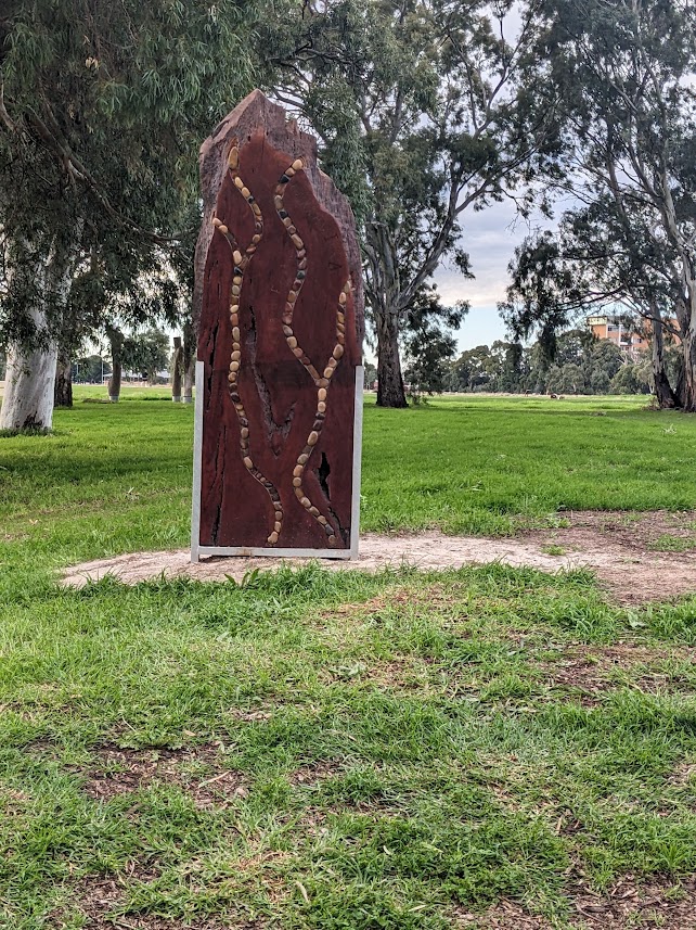
In 1997, recognising Kaurna heritage, and the prior occupation of this land by the Kaurna people, the Adelaide City Council drew up a Reconciliation Vision Statement and committed to a dual naming project of all the squares within the city centre and to each of the parks throughout the parklands. Working closely with Kaurna Warra Pintyanthi (KWP), Kaurna Elders and Council’s Reconciliation Committee, the Adelaide City Council has assigned both a Kaurna and an English name to every park and square. Thus, Victoria Square is also signed Tarntanyangga, and the River Torrens also bears the name Karrawirra Parri.
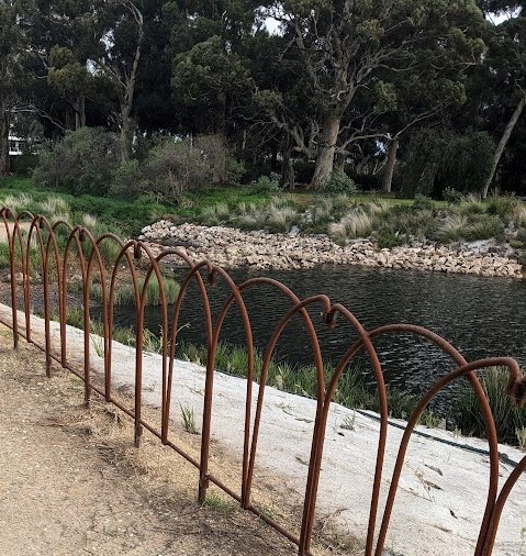
And while the parklands have been trimmed to widen roads – or to build that ridiculous tunnel for the O-bahn buses – the parklands still offer Adelaideans a great expanse of free space and sports grounds. They are also much cleaner and better cared for than they have been in the past. Today, while native animals are still scarce, there is a plethora of birds: the galahs feed on the ovals at twilight; the ducks bob about in the wetlands and along the river; the magpies chortle in the gum trees, and a vast colony of fruit bats chitter in the trees on the edge of Botanic Park.
As a child, I remember playing on the pirate ship climbing frame in the west parklands at Bonython Park/ Tulya Wardli. This park was also where the circus set up when it came to town, although the lions frightened me away at an early age. Popeye – a green riverboat – took sightseers from the weir to the Festival Centre and on to the zoo for almost fifty years. Named after the cartoon character, the first Popeye was built of jarrah and launched in 1935, and could hold up to twenty people. Four more, slightly larger Popeyes soon followed. These operated until 1982, when the iconic green wooden boats were replaced by three blue, fibreglass passenger ferries that can seat eighty passengers each. A sign on the Lounder’s Boathouse claims that “Adelaide wouldn’t swap this miniature waterway and fleet for the Grand Canal and all the gondolas of Venice.” Today, there are also paddle boats and two, round BBQ boats for hire along the banks of the Torrens.
On the eastern side of the parklands, dog walkers still do laps of the old Victoria Park Racecourse aka Pakapakanthi. Home of the Adelaide Racing Club until 2010, when the horses were moved to Morphettville, Victoria Park/Pakapakanthi is better known these days for its Supercar races. And for a decade (1985-95) it was also the venue for the Australian Grand Prix. Today, keen cricketers bring their families for a day of play and picnics.
In the North Adelaide parklands below LeFevre terrace, you can still see horses – a long tradition that has been maintained since the times when local delivery men kept their cart horses here. Scattered throughout the parklands are sports fields, tennis courts, an archery club, boatsheds, a golf course, a swimming pool, and of course the iconic Adelaide Oval.
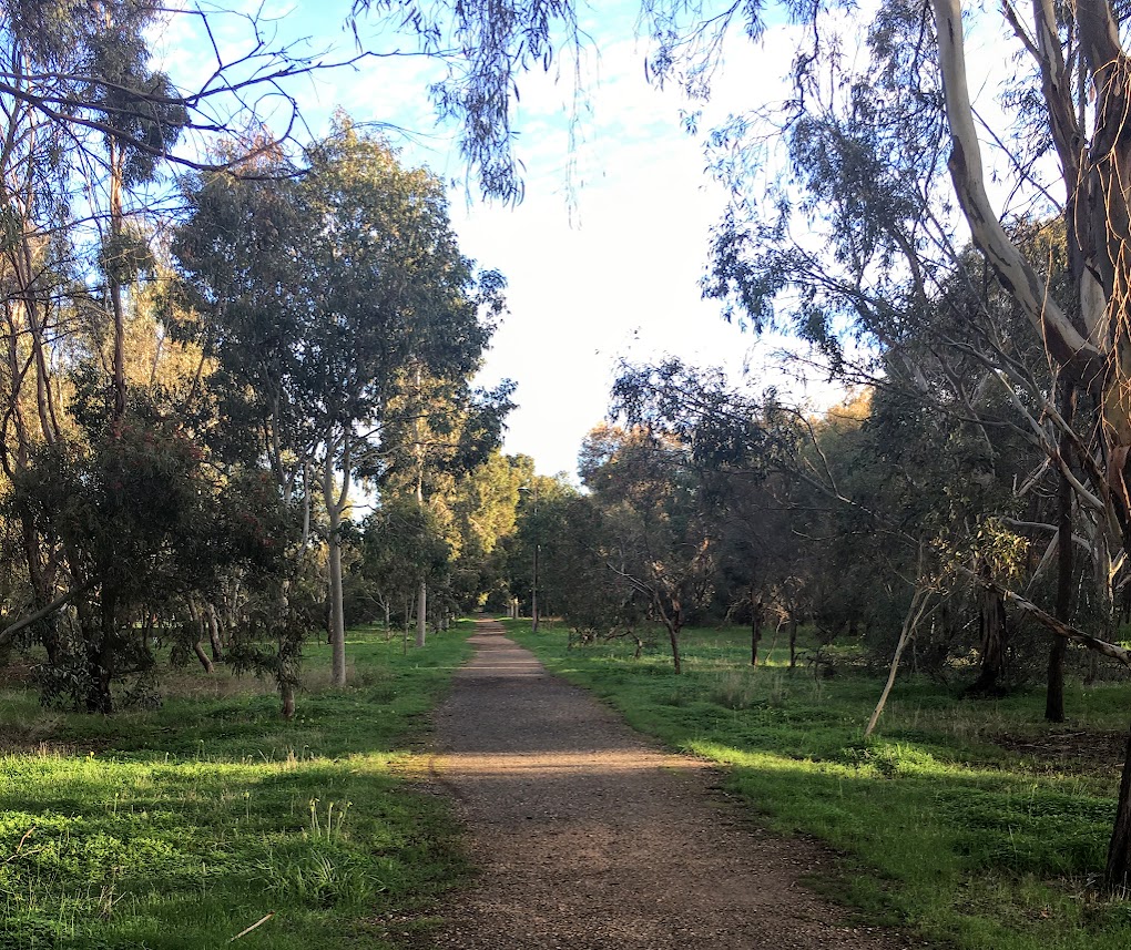
There is a zoo, a botanic gardens and a couple of public high schools. There are dog parks, playgrounds and barbecues. An old olive grove still stands on parklands beside East Terrace, another in the north parklands near Melbourne Street. And, quite recently, the wetlands established in the southeast corner have added a new dimension to the walking paths around the old racecourse. Cycle paths allow riders to dodge the city bound traffic, and eucalypts, once replaced by shady English trees, are gradually returning. Although you can still find the remains of an old carriageway lined with elm trees in the south parklands near St Andrew’s Hospital.
During the Adelaide Fringe Festival in February and March, Rymill/Murlawirrapurka Park, (the name of a Kaurna Elder early colonists referred to as King John), has become the home of Gluttony, while neighbouring Rundle/Kadlitpina Park (named after another Kaurna elder at the time of British settlement) hosts the Garden of Unearthly Delights. For weeks, these parks are packed with people, tents, food and performing artists of all kinds.
At quieter times of year, the parklands provide a wide variety of walking paths. While I have done sections of the linear park along the Torrens – a 30km hike from the hills to the sea – I have yet to walk the Adelaide Park Lands Trail. This 19.5km loop around the city, takes walkers and cyclists through every aspect of the parklands. And unlike those dreadful smogs in London, the air is as clear as Sesame Street! Maybe, when spring has finally sprung, I will go a-wandering…